Colours represent the first human arrival in a given area.
It is largely subjective how to define where a “people” starts and ends. When one group supplants another in any given area it is usually not a complete replacement. Cultures will always blend to some degree.
It is also largely subjective how to define a “people”. Take Nunavut in Canada as an example. While an area such as Nunavut is mostly populated by “Indigenous” (as in those who lived in the area before the arrival of Europeans) people, the inhabitants of Nunavut are almost entirely descendants of the Thule people, who were preceded in the area by Dorset people, who were in turn preceded by the pre-Dorset people. To Europeans, the people of Nunavut are indigenous, to the pre-dorset they are not.
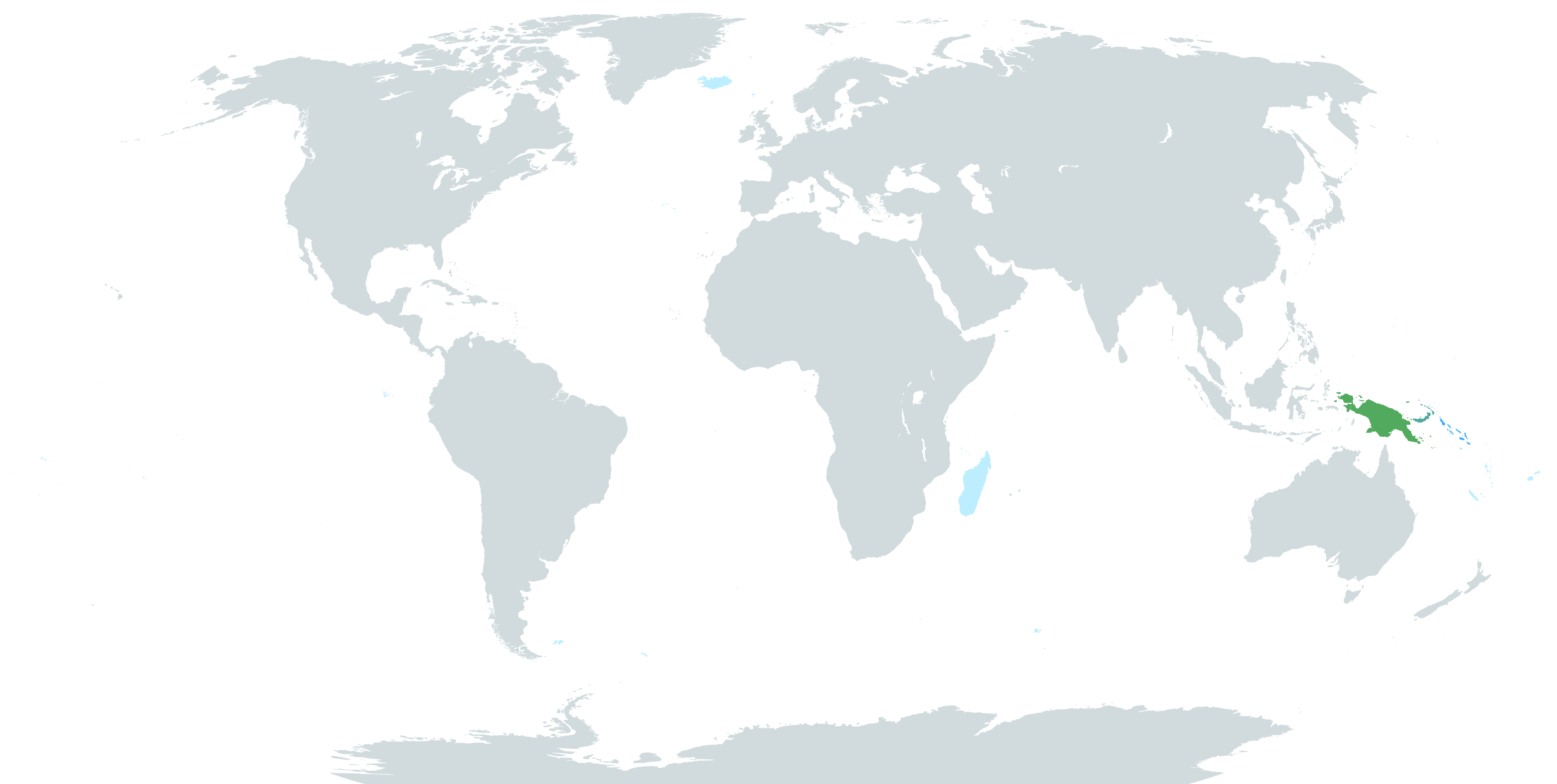
The final selection of areas still mostly inhabited by their first inhabitants for this website is notably comprised only of islands and, with the exception of New Guinea, is only comprised of areas settled in the last 5000 years. This selection includes Iceland, whose first inhabitants were and are the Norse; New Guinea along with most of Melanesia, which has likely been inhabited by Melanesian people since humans first arrived there; and Madagascar along with almost all of the islands of the Pacific, which have only ever been inhabited by Austronesians.
The point of highlighting these areas is to show that unless a person lives in one of these very specific places, their people are likely not the original inhabitants of where they live. It is the opinion of the creator of this map that too much conflict in the world is caused by claims of: “We got here first!”. Hopefully, by showing that almost no one got to where they are first, this map can help combat that misconception.